Featured Mission – February 2025: Protecting Utah’s Iconic Landscapes with the Aerial Perspective

Photo by Cody Perry
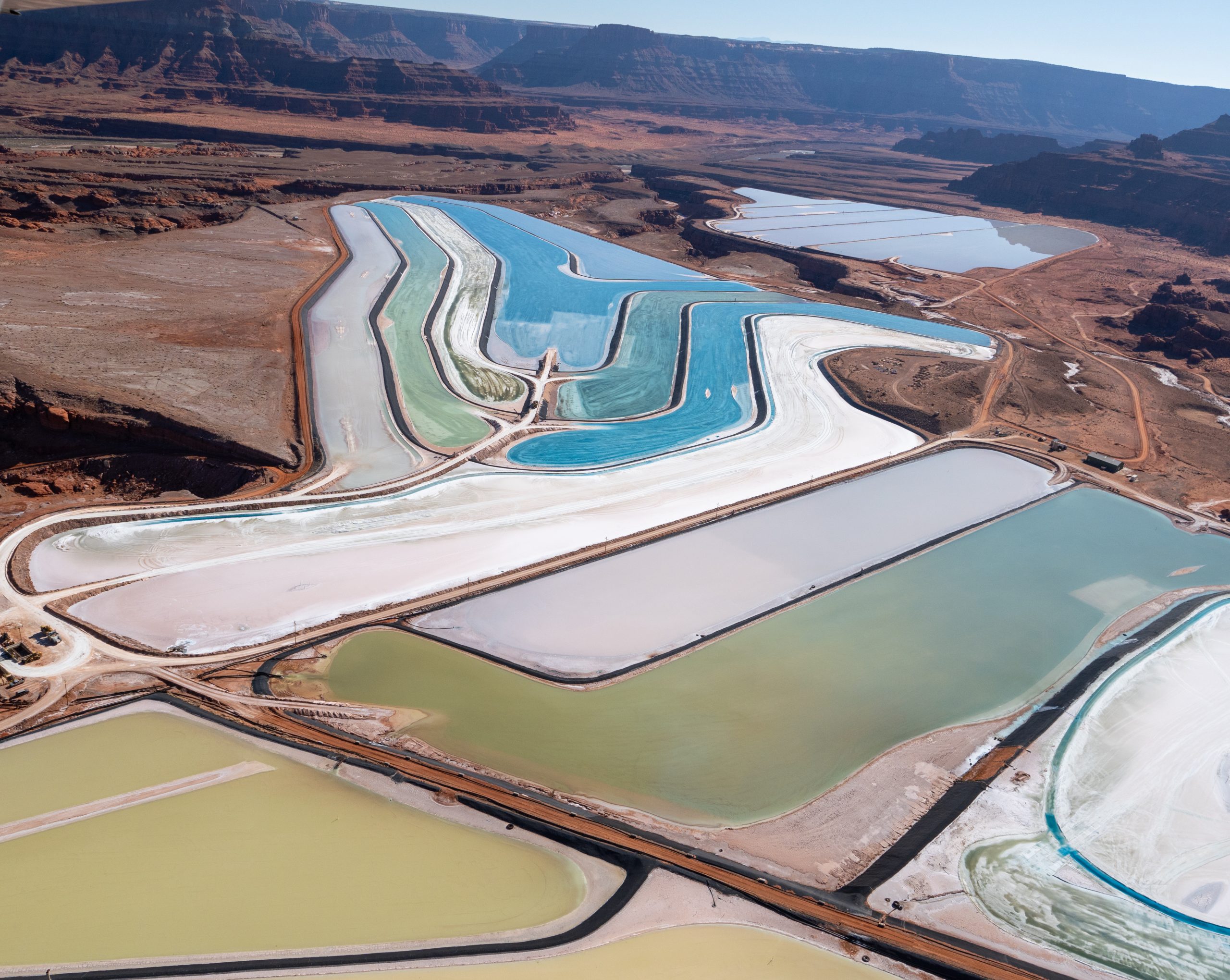
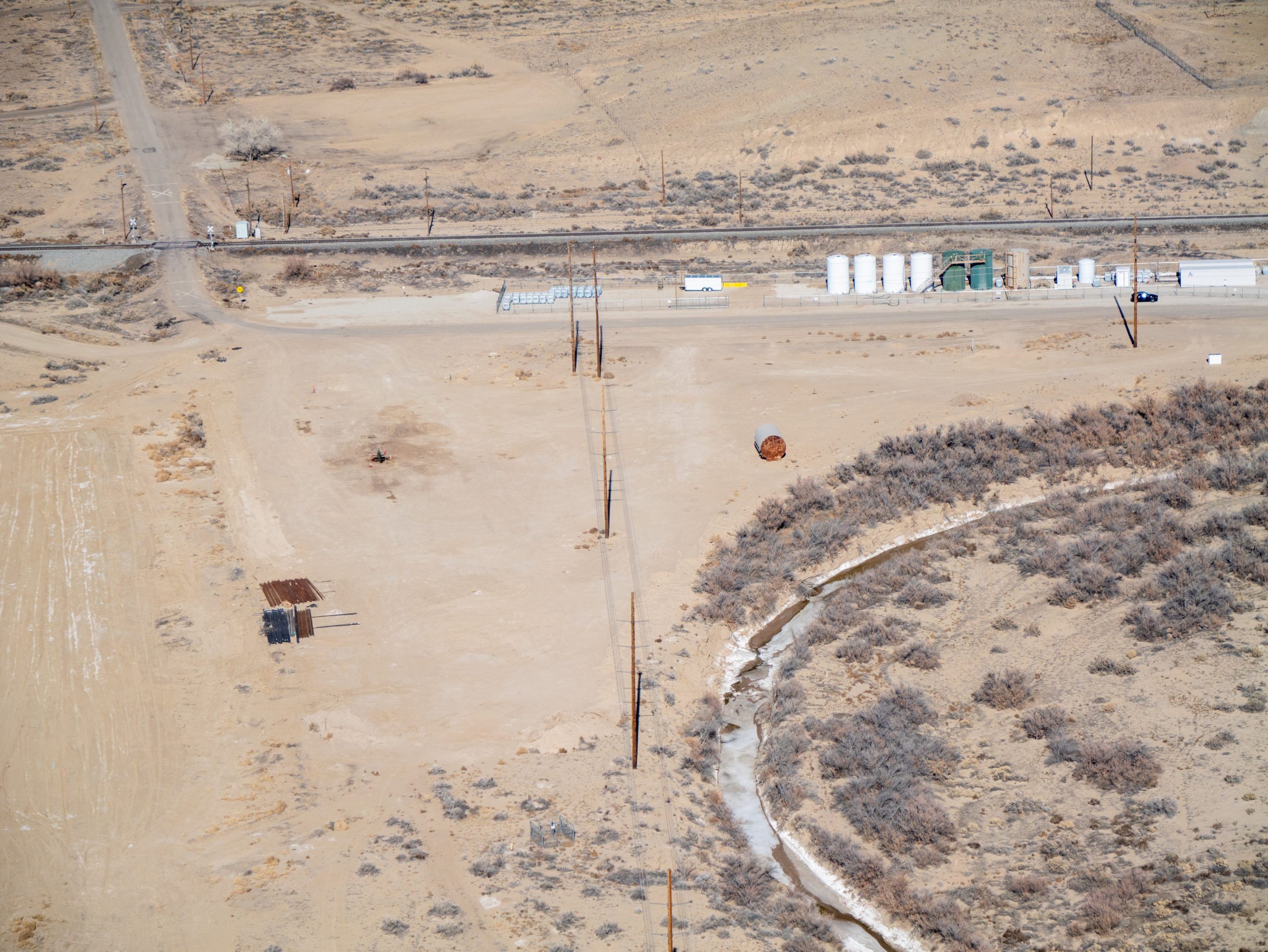
The flight flew over an existing industrial Potash mine evaporation site near Moab, Utah and the Colorado River.
The Mission
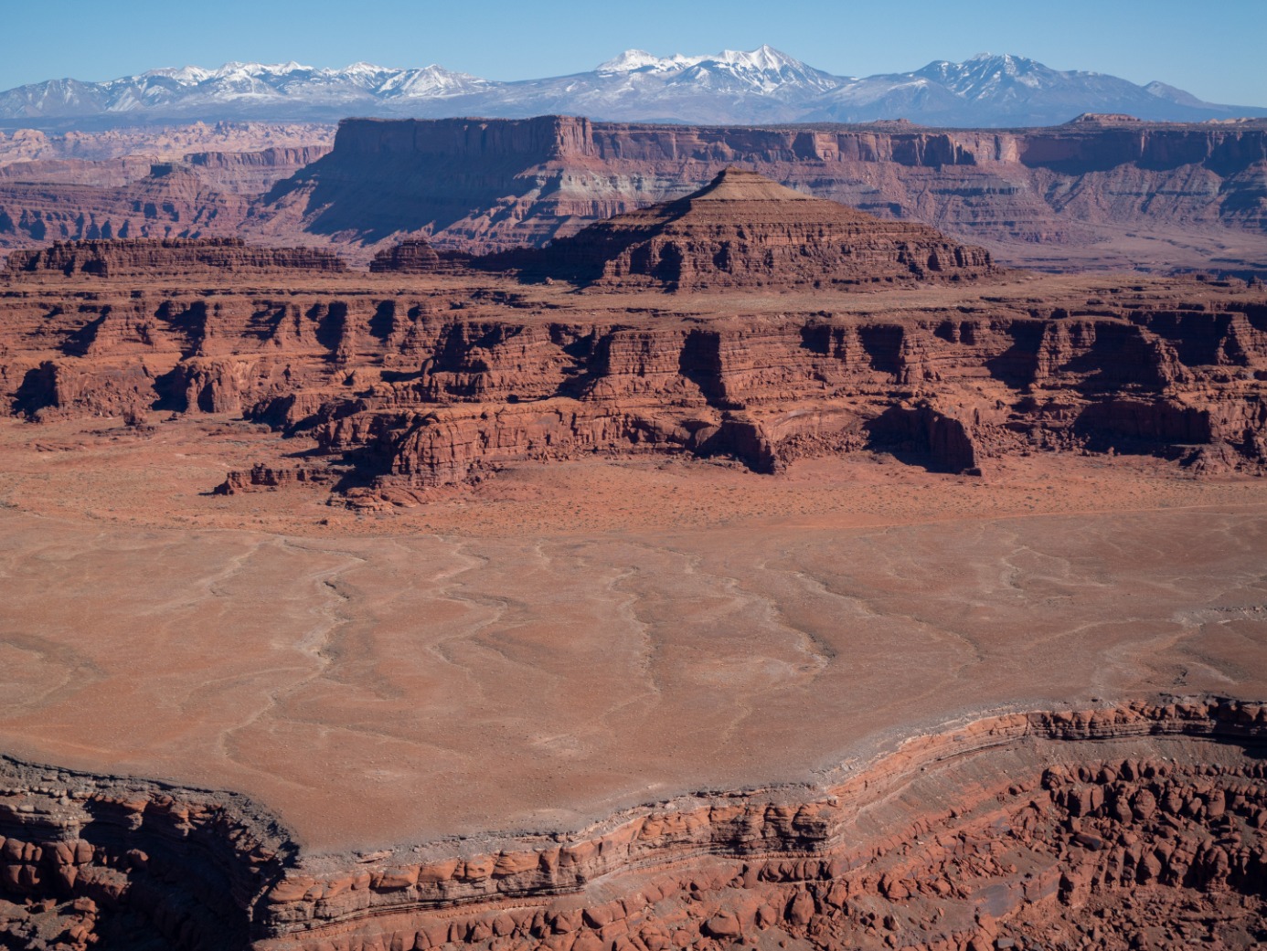
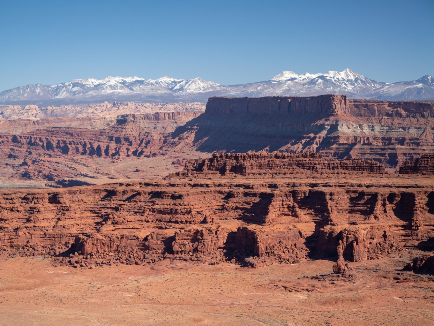
Technology is a double-edged sword. While it enhances our daily lives and increases productivity, the process of extracting the metals needed for batteries to power our electronics can be devastating to the environment. This month, we highlight a mission in Utah to document potential drill sites near breathtaking red rock formations.
The Issue
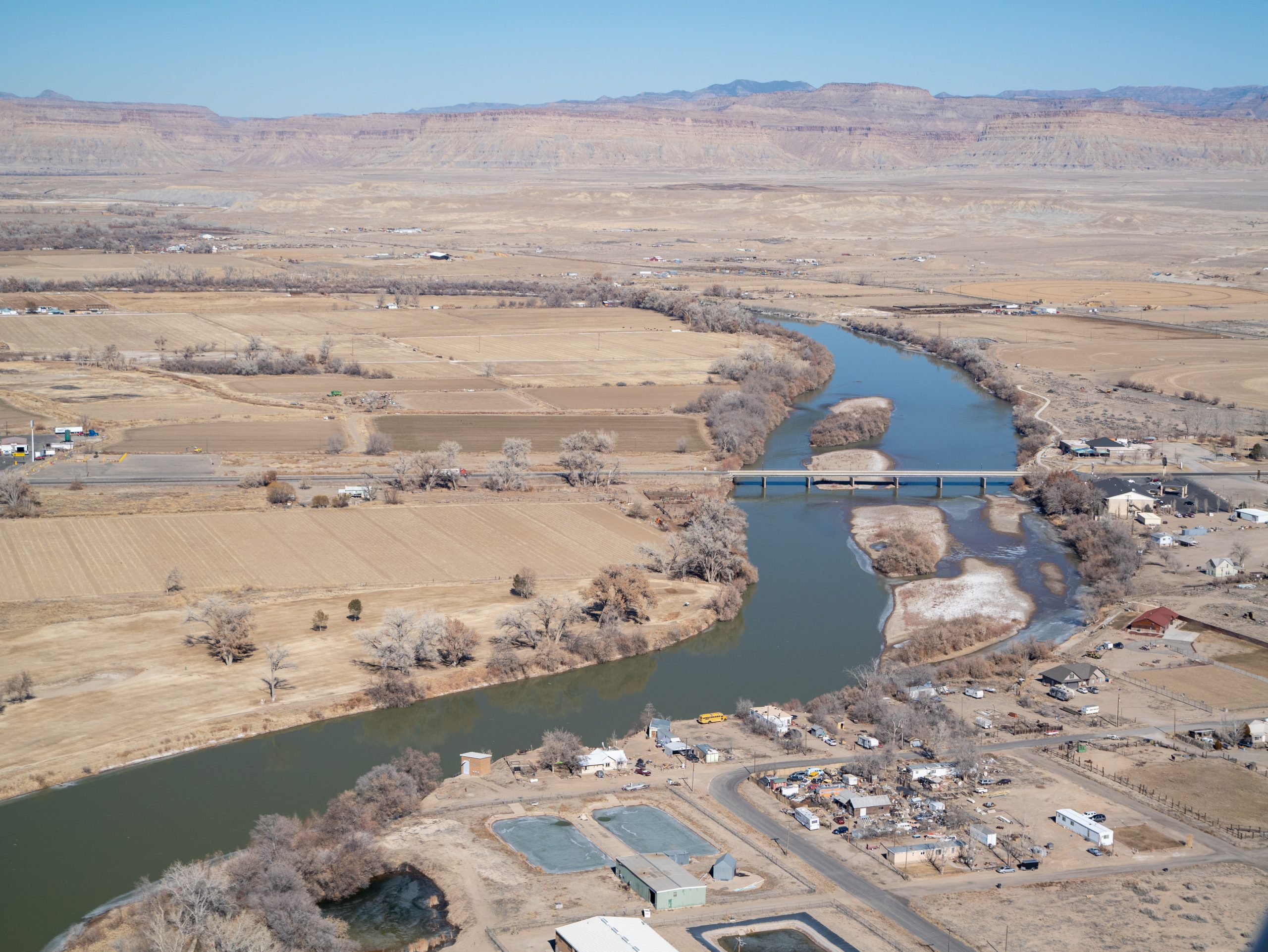
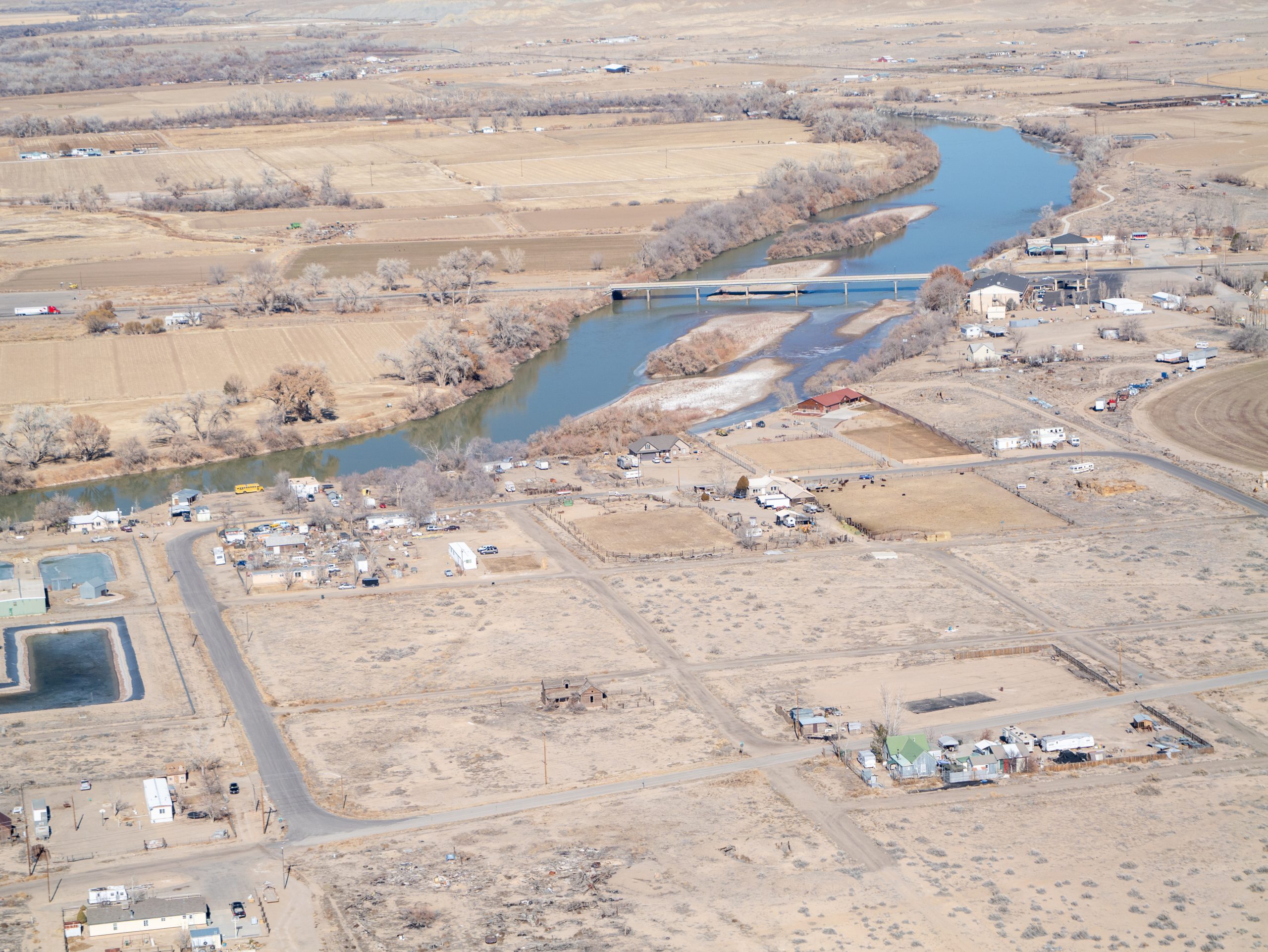
Earlier this year, conservation partner Rig to Flip teamed up with LightHawk to document Utah’s landscapes at risk from industrial development. Four exploratory drill sites for lithium and potash have been proposed on the eastern portion of Labyrinth Canyon. These wells would require immense amounts of water, and if full-scale operations proceed, demand will rise dramatically. With water in the Colorado Basin already overallocated, its demand outpacing supply most years, a prolonged drought has only deepened the crisis, forcing tough decisions across the region.
To shed light on these threats, the flight captured high-resolution photos and video of the iconic Redrock terrain currently in the crosshairs of extraction and expansion. The flight focused on collecting digital imagery, both photos and video, highlighting iconic Redrock terrain currently in the crosshairs of extraction and expansion. The flight route took passengers along the border of Arches National Park, offering a striking aerial perspective of the threatened landscape.
The Flight
LightHawk volunteer pilots Lee Gerstein and John Priscu departed from Moab Airport with passengers coordinated by Rig to Flip. Along the way, the passengers captured photos and video of the region’s natural landscapes, rivers, and nearby drilling and mining operations.
Among the passengers was County Commissioner Trisha Hedin, who shared her perspective on the experience:
“This flight allowed me a large-scale overview of the landscape and those areas that might be impacted by future proposed lithium mining. It also allowed me to see the proximity of these explorations in correlation to other existing industries. The pilot and the plane were amazing!”
Social media influencer “Western Water Gal” (Teal Lehto) was also on the flight, using her platform to amplify the message. She produced a video discussing the issue and featuring video from the flight for her 64,000 TikTok followers and another 10,000 on Instagram.
The imagery collected on the flight will be used for outreach materials and press coverage to highlight the Bureau of Land Management’s (BLM) decisions regarding land use. The group intends to focus on the proposed drill sites and their impact on water resources.
As one of the nation’s most beautiful and iconic landscapes, situated along one of our most vital waterways, it’s important to bring attention to the threats the proposed drill operations pose to the area. The aerial perspective makes the issue clear, revealing how drilling could put scenic rock formations and the river at risk.
Thank you to volunteer pilots Lee Gerstein and John Priscu for generously donating their time and expertise to make these flights possible.

Photo by John Priscu

Photo by Cody Perry

Photos by Cody Perry